Johto in one pass
Three weeks of drawing a Pokémon world map with image models, from tiles to one image per island to all of Johto in a single call, and the fixes that came after.
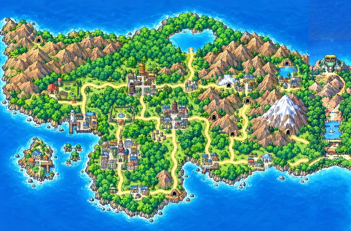
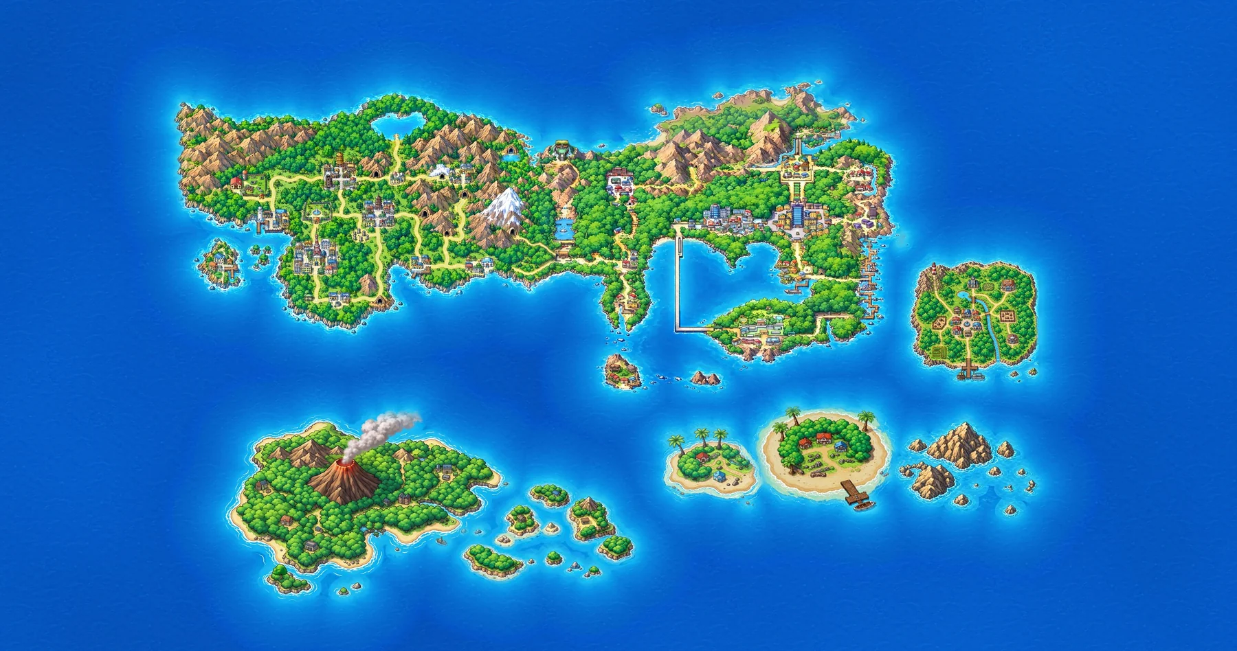
The island map is the world map for pokegram, a Gen 1 remake for phones and Telegram that João’s group of friends is making. Kanto exists as finished art. Johto and six more islands had to be drawn. After three weeks of building tools to draw Johto in pieces, GPT Image 2.5 drew all of it in one call.
Before one image per island
Before the first commit João tried the obvious route to a big map: cut the art into a grid and have an image model redraw each tile at a higher resolution, with the original as reference. The tiles didn’t hold together: “we could not maintain the artistic vision and consistency from these outputs”. And from outside there was no way to steer the model itself: “we don’t have proper internal access to the models to control the noise”.
So the project started from the opposite end: one image per island, generated whole, cut out and placed on an endless sea. This article follows Johto, the island that took the most attempts.
Johto at Kanto’s scale
The first Johto looked like a map but had the wrong size. Its buildings came out about three times bigger than Kanto’s, so the two halves of the mainland didn’t belong together.
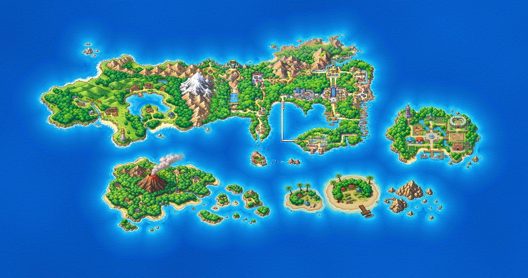
An image model picks how big to draw details for each image, not for the world. The fix was to put real Kanto art in the frame next to the empty land, so the model sees the size of a house before it draws one. GPT Image 2 kept that scale; Nano Banana didn’t, and painted the town names from the labelled plan onto the map. GPT went first from then on, and Nano only refined at 4K. Every generated image also carried a strip of Kanto, which let the engine line it up with the real art to within a fraction of a degree.
Then the input became a flat-colour plan: the Gold/Silver layout painted as blocks, with a coloured dot for each landmark (red for the radio tower, white for the lighthouse, black for a cave).
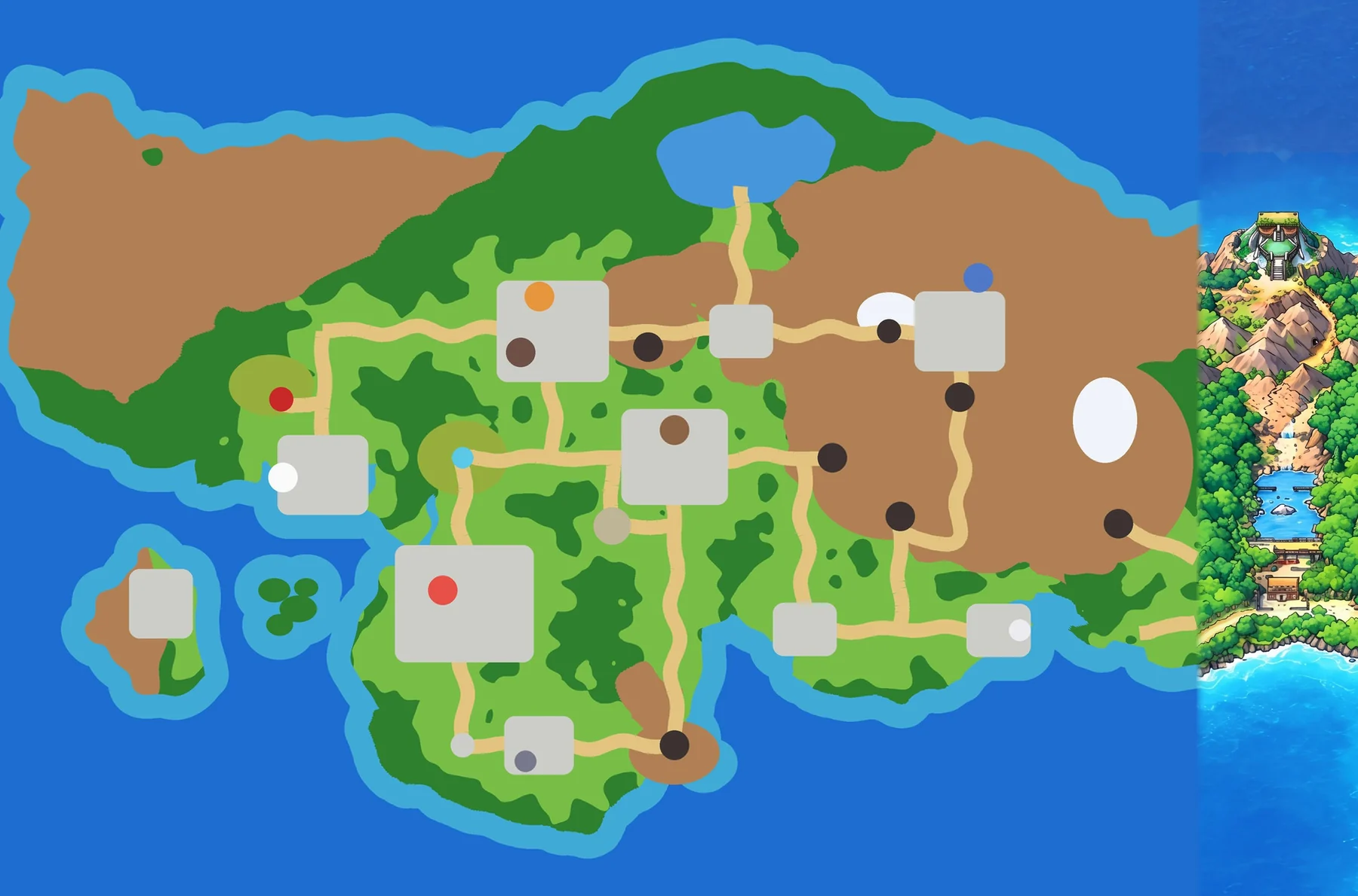
That got the layout right, but it took steps: plan, GPT Image 2, Nano Banana at 4K, sections redrawn, masked fixes. GPT Image 2 also stretched Johto by 16 to 20 %.
One call
Then 3D AI Studio’s credits ran out, and the Generate tab moved to OpenAI’s API. João had reasons beyond the credits: through the studio’s connector he couldn’t reach the newest GPT image models, and had no selective edits, no 4K and no transparent backgrounds. And on the API he pays for what he uses, instead of a monthly allowance he felt pushed to spend.
The first test was the whole plan, in one call, at the largest size the API takes in that shape: 3536 × 2336 px, about 90 seconds an image. The low-quality drafts already kept the coast, the roads and every town in place, with no stretching. Seven full-size images followed. The chosen one needed two fixes against the plan: a missing cave at Mt. Mortar and an extra one in the north-west.
Why one pass over the steps, in João’s words: it was more consistent to draw the whole map at once, and every extra edit made the picture a little worse. The old version’s perspective was off too, and of the new one he says “the newer was more in the art style and better drawn”.
Fixing without redrawing
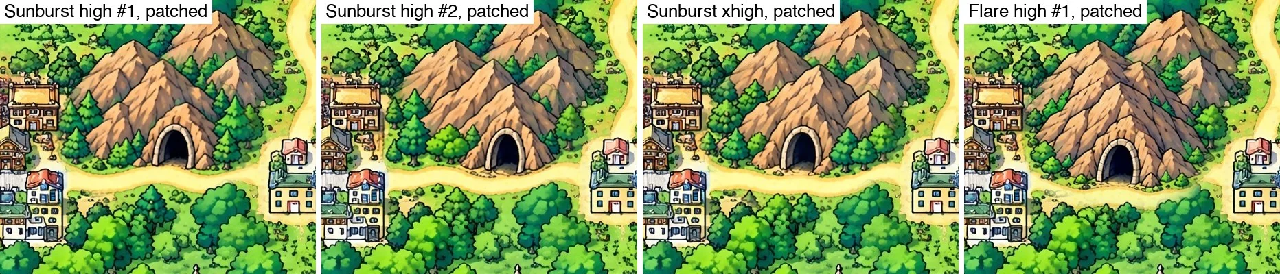
A model asked to change one thing redraws everything. So every fix works on a 1024 px crop at full resolution, with an ellipse painted over the fault. The result is lined up with the crop and blended back only inside the mask; whatever the model changed outside is thrown away. Measured on the Mt. Mortar fix, a crop edit changed the area it was told to keep by about 10 levels out of 255 on average. The same edit on the whole image changed it by 17: the whole picture redrawn.
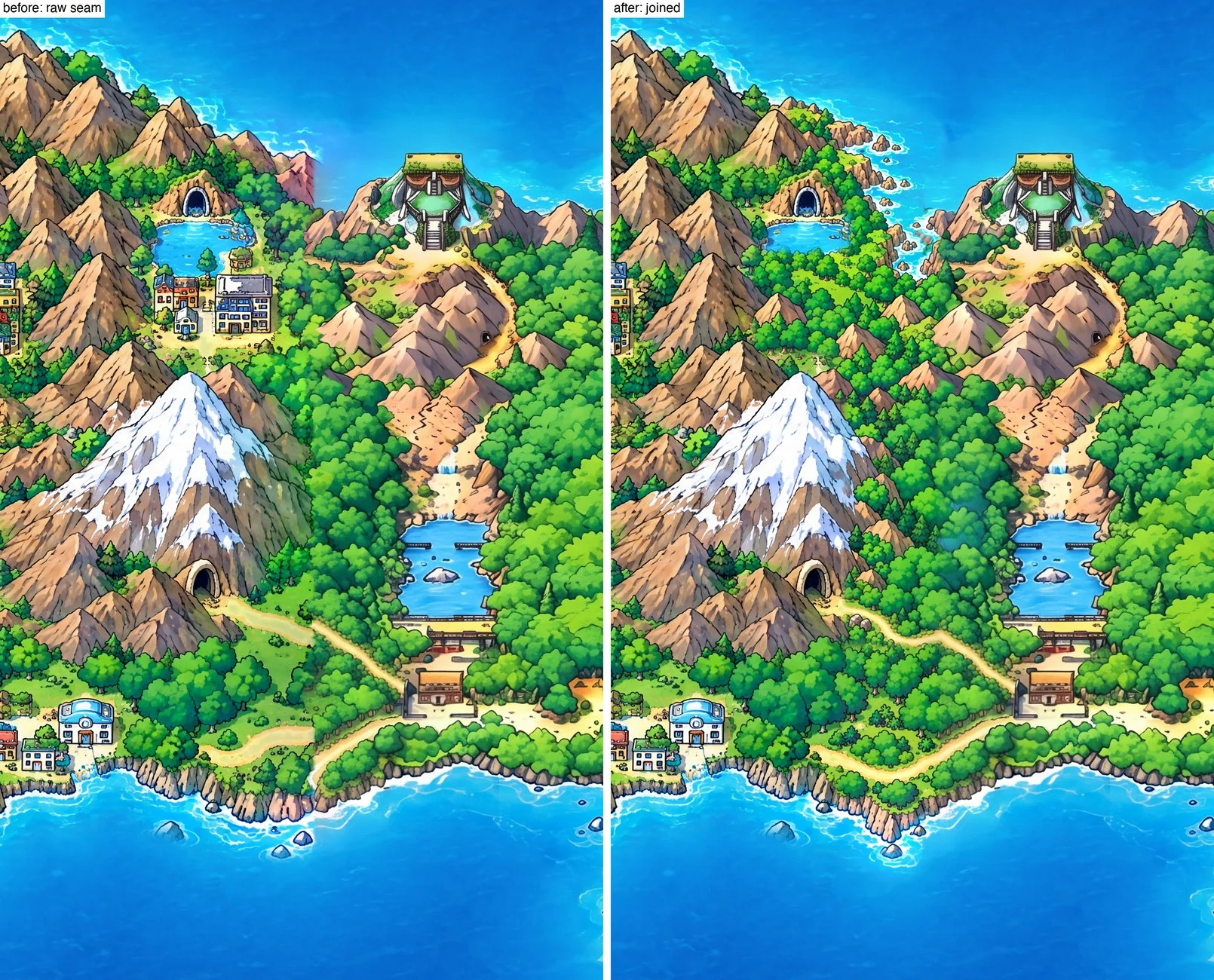
Joining the new Johto to Kanto took three masked edits down the seam: the north coast curved down to the Indigo Plateau, Mt. Silver’s slope run into Kanto’s forest, Route 27 made continuous. Then a fourth across the line where two edits met.
Six rounds
When it was done, the map went to his friends. João doesn’t want anyone named, but “there were feedback rounds with the guys, and they helped making the edits more precise”. Their round was about how the game plays, not how the map looks: the road ran past Ice Path straight into Blackthorn, when in the game the only way in is through the cave; Routes 32 and 33 met in front of Union Cave, so it could be skipped; Route 42 was a plain road instead of ponds that need Surf.
The next five rounds came from João’s own reviews. Zoomed in, he checked each edit for what the model had missed, because “model vision is not perfect so you have to pay attention to that”. He found a cave mouth facing the sea, the faded peak of a new mountain, a teal band where the two pictures cross-faded, and a cave sitting across Route 45 that made the road reach Blackthorn only through it. In the Library, round five is the only map he has rated five stars.
What it taught
The biggest change was giving Claude the image model’s API keys. The images came out closer to what João wanted and more consistent, and Claude could then refine them and fix what the model got wrong.
The other lesson was about the tool. The editor grew to nine tabs, with a mask brush, version grids and a GPU compositor, while the model ended up doing most of the work. João:
I learned that I should have not over engineer the tool, keep it simple and minimal, so that does not end up like the editor full of features that I don’t use